Atlas walk · London
London street art walk: Shoreditch, Brick Lane and Spitalfields
Eleven stops from the Village Underground wall to the Whitechapel Gallery, through the streets where London's painted walls change fastest. Untick what you want to skip and the planner recalculates the walk.

We earn a commission on some bookings.
Start at Shoreditch High Street station (London Overground).
The long street wall of a music venue on Holywell Lane, repainted by invited artists, with old Tube carriages on the roof.
3 min walk · 0.3 km (0.2 mi)
A short street by Shoreditch High Street station whose long wall has carried large pieces for years, lately a 45-metre text work by Ben Eine.
4 min walk · 0.3 km (0.2 mi)
A raised garden and bandstand at the heart of one of London's first council estates, opened in 1900 on a cleared slum.
6 min walk · 0.4 km (0.3 mi)
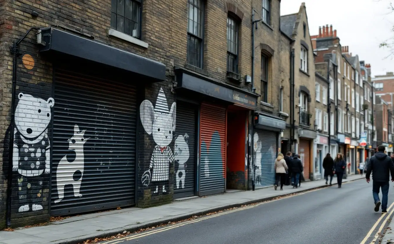
Shutters, side walls and paste-ups around Sclater, Cheshire and Bacon Streets, the most changeable stretch of the walk.
4 min walk · 0.3 km (0.2 mi)
The brewery that closed in 1989, now studios, markets and yards along Dray Walk, with painted walls that change between visits.
3 min walk · 0.2 km (0.1 mi)
A huge black and white crane painted by ROA in 2010 just off Brick Lane, one of the longest-surviving pieces in the area.
5 min walk · 0.4 km (0.2 mi)
A Victorian market hall on a site that has traded since the seventeenth century, now stalls and food under a glazed roof.
2 min walk · 0.2 km (0.1 mi)
Nicholas Hawksmoor's white stone church of 1714 to 1729, whose spire anchors every view down Fournier Street.
2 min walk · 0.2 km (0.1 mi)
Silk weavers' houses of the 1720s leading to a 1743 building that has been church, chapel, synagogue and, since 1976, a mosque.
8 min walk · 0.6 km (0.4 mi)
The site of the old white chapel, renamed in 1998 for a murdered garment worker, with a Shaheed Minar memorial.
2 min walk · 0.2 km (0.1 mi)
A public gallery since 1901, with Rachel Whiteread's gilded leaves on its facade and a changing programme of exhibitions.
Your walk
- Stops
- 11
- Walking
- 2.9 km (1.8 mi), 39 min
- Looking
- 3 h 10 min
- Altogether
- 3 h 49 min
- Finish around
- 13:49
Distances are straight lines between stops times 1.3, a usual allowance for streets that don’t run where you want them to. Add time for coffee, crossings and the wall you didn’t plan on.
The route planner above starts with eleven stops ticked, in walking order from Shoreditch High Street station to Aldgate East. Untick any you want to skip and the planner redraws the route and recalculates the distance and a rough walking time. It works as a half-day walk, or a full day if you give the Whitechapel Gallery the time it deserves. Walls here change faster than anywhere else in London, so the route is anchored on places that last, and the pieces between them will differ from any photograph, including ours.
The route
The walk crosses from Hackney into Tower Hamlets, through three districts that blur into each other. You start in Shoreditch, with the big set-piece wall on Holywell Lane, then cross Shoreditch High Street, pass Ebor Street and walk north into the Boundary Estate. From Arnold Circus you drop down Club Row to the top of Brick Lane, follow it south through the old brewery to Hanbury Street, and turn west to Spitalfields Market and Hawksmoor's church. Fournier Street brings you back to Brick Lane, which you follow south to Whitechapel Road. The finish, at the Whitechapel Gallery, is next to Aldgate East station.
The stops
Village Underground wall
Village Underground is a music and arts venue in a Victorian warehouse on Holywell Lane, with old Underground carriages lifted onto its roof as studios. Its long street wall works like a billboard for painters: invited artists cover it with one large piece, which stays until the next one replaces it. Over the years it has carried work by Phlegm, Fanakapan and many others, so what you find is a matter of timing. Cross to the far side of the lane for the whole wall, and come early if you want it without people in front.
Ebor Street
Walk back towards the station and into Ebor Street, a short street close by. Its long wall has carried large pieces for years, and a guide published in spring 2026 listed a 45-metre text work by Ben Eine there, a painter known for his big, bright letters. Whether or not that piece survives, large new work keeps appearing here. The street is narrow and used by vans, so keep to the side.
Arnold Circus and the Boundary Estate
Turn north to the Boundary Estate, opened in 1900 by the London County Council as one of the earliest council estates, on the site of a notorious slum known as the Old Nichol. Red brick blocks with striped detailing radiate from Arnold Circus, a raised circular garden with a bandstand, said to stand on a mound made from the rubble of the cleared streets. It is a planned piece of civic design rather than street art, and a calm place to sit. People live here, so keep your voice down and your camera off their windows.
Sclater Street and the top of Brick Lane
Go down Club Row to where Sclater Street meets Brick Lane. This is the most changeable stretch of the walk: shutters, side walls, doorways and drainpipes around Sclater, Cheshire and Bacon Streets carry paste-ups, stencils, small sculptures and full murals, and much of it turns over within weeks. Look up to first-floor level and along rooflines, where smaller pieces survive longer. On Sundays the street market fills these streets and seeing anything is harder, so come on a weekday for the walls.
Old Truman Brewery
Truman's brewed beer on Brick Lane for about three centuries until the brewery closed in 1989. Its sprawling buildings now house offices, studios, food stalls, shops and weekend markets, and the yards along Dray Walk are a regular site for commissioned pieces and quick, unofficial work alike. The tall chimney is the landmark that tells you where you are. It is private property, open to the public but managed, so walk in through the main yards rather than around the back of buildings.
ROA's crane, Hanbury Street
Just off Brick Lane on Hanbury Street, the Belgian painter ROA made a huge black and white crane in 2010. He had planned a heron, then changed it after learning that the crane carries special meaning for the area's Bengali community, many of whom have roots in Sylhet. In 2012 a council banner covered it for a time. It is one of the longest-surviving pieces in the area, and it rewards a slow look. Look from the corner with Brick Lane.
Old Spitalfields Market
Walk west along Hanbury Street to Commercial Street. A market has traded on this site since the seventeenth century, and the covered Victorian hall dates from the 1880s. The wholesale fruit and vegetable trade moved out to Leyton in 1991, and the market now holds stalls, food traders and shops under a glazed roof. It is not a street art stop, but it explains the area: trade, migration and redevelopment also decide which walls get painted and which come down.
Christ Church Spitalfields
Nicholas Hawksmoor's church, built between 1714 and 1729, stands across Commercial Street from the market, its white stone spire rising high above the market roofs. It was built for the growing population of the area, much of it Huguenot refugees from France. Inside it is pale and enormous, and it hosts concerts and events, so check opening times before you go. If the door is shut, the steps make a good place to look back down Fournier Street, the next stop.
Fournier Street and Brick Lane Jamme Masjid
Fournier Street was built in the 1720s, and many of its houses were home to Huguenot silk weavers, whose wide attic windows let in light for the looms. Walk east along it to Brick Lane. On the corner stands a building of 1743 that has been a Huguenot church, a Methodist chapel, a synagogue and, since 1976, a mosque: the whole history of East End migration in one set of walls. Its sundial carries the Latin words Umbra Sumus, we are shadows. It is a working mosque, so be discreet around prayer times.
Altab Ali Park
Follow Brick Lane south to Whitechapel Road. This small park stands on the site of the medieval white chapel that gave the district its name, destroyed by bombing in the Second World War. In 1998 it was renamed after Altab Ali, a 25-year-old Bangladeshi clothing worker murdered in a racist attack nearby in May 1978; his death brought thousands onto the streets. The park holds a replica of the Shaheed Minar in Dhaka, honouring those killed in the 1952 Bengali language movement. It is a place of memory, and should be treated as one.
Whitechapel Gallery
End a few steps west at the Whitechapel Gallery, which opened in 1901 in a building by Charles Harrison Townsend to bring art to the East End. It showed Picasso's Guernica in 1939, and its facade carries Rachel Whiteread's gilded bronze leaves, added in 2012, which catch the light on the old stone. The exhibition programme changes through the year, so check what is on before you go. The gallery has a bookshop and a café, and Aldgate East station is next door.
Practical notes
- Timing: weekday mornings are quietest. Weekends bring markets, crowds and group tours.
- Respect: the Boundary Estate, Fournier Street and the streets off Brick Lane are homes. Do not sit on doorsteps, block entrances or photograph people without asking, and be considerate around the mosque.
- Painting: none of these walls is open for painting. London's best-known place where painting is allowed is the Leake Street tunnel near Waterloo, well away from this route.
- Change: if a wall in our list has been repainted, look at what replaced it. Our guide to planning a self-guided street art walk explains how to find fresh pieces in any city.
Further reading
Rick Steves' Pocket London covers the rest of the city in a size that fits a jacket pocket. Subway Art, Martha Cooper and Henry Chalfant's record of New York trains, shows where much of the painting on these walls comes from, and Stephanie Bower's Urban Sketching Handbook is full of short tips if you want to draw Fournier Street or Hawksmoor's spire. These picks come from publisher details and published reviews rather than our own testing. For the same kind of walk elsewhere, try our Berlin street art walk or the Glasgow mural trail planner.
Questions
Where does the Shoreditch street art walk start?
This route starts at Shoreditch High Street station on the London Overground and ends at Aldgate East station, so you never have to retrace your steps. You can join it anywhere along the way.
Is there still Banksy art in Shoreditch?
Very little. Most of Banksy's East London pieces have been painted over, damaged or removed, and the few that survive sit behind perspex on private property. This walk concentrates on walls you can count on.
When is the best time to see Brick Lane street art?
A weekday morning, when the shutters are still down and the streets are quiet. On Sundays the markets make it hard to see the walls at all.
Is the London street art walk free?
Walking it costs nothing. Every stop is on a public street, in a park or in a building you can walk into, though some gallery exhibitions are ticketed, so check before you go.